About
About Yamhill Rivers
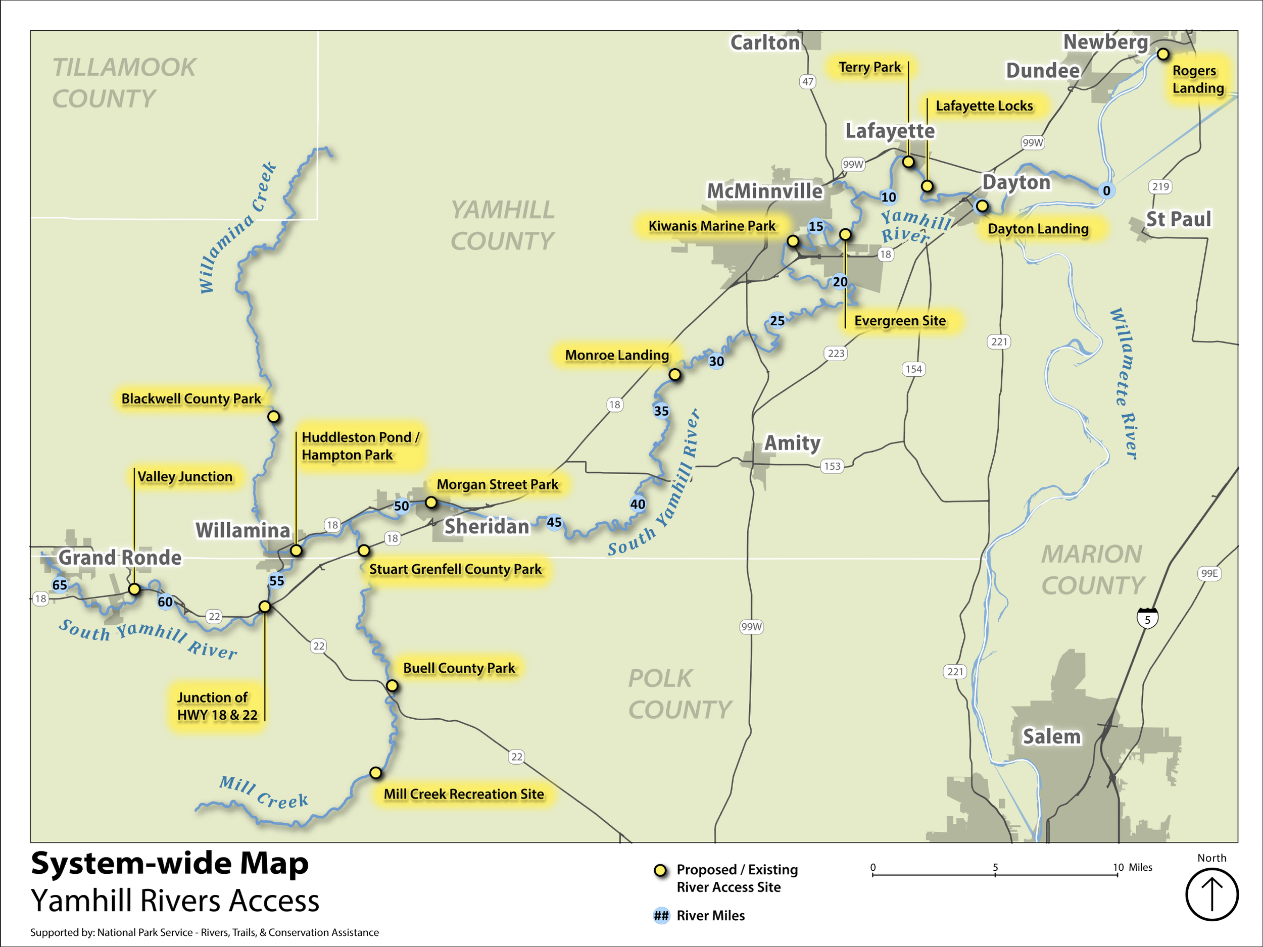
The North Yamhill, South Yamhill, and main stem Yamhill Rivers, along with Mill and Willamina Creeks, comprise more than 120 river miles with both flat and whitewater sections.
Collectively referred to as the Yamhill Rivers, these waterways have much to offer in the way of year-round, family-friendly recreational opportunities including wildlife viewing, floating, fishing, whitewater rafting and paddling.
However, formal access is limited, and lack of improved access can be a challenge to enjoying the river.
About the Yamhill Rivers Access Project
Vision
Creating a connected system of clear and safe access to the Yamhill Rivers as a shared natural resource for boating, recreation, and other water-based activities. Cultivating this river access connects communities, strengthens stewardship, and creates opportunities to support local businesses and the regional economy.
Goals
Recreational Access. Local residents and visitors have safe, equitable, and convenient access to a system of diverse, river-based recreational opportunities.
River Conservation. River health, fish, and wildlife habitat are protected through stewardship, community education, and sustainable recreation management.
Economic & Community Growth. Local businesses and economies are thriving from river-based recreation and tourism, drawing in families to live and play in the Willamette Valley.
Partnerships. Local governments, community organizations, and residents are united in coordinating river access, sharing resources, and diversifying funding to sustain Yamhill Rivers Access.